
Tsum Valley Trek Distance: The Complete 2026 Guide to Nepal's Hidden Valley of Happiness
3rd Sep, 2026
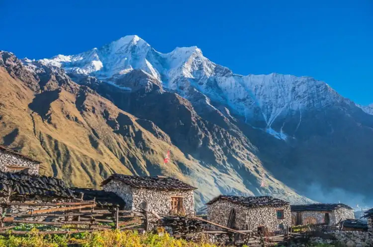
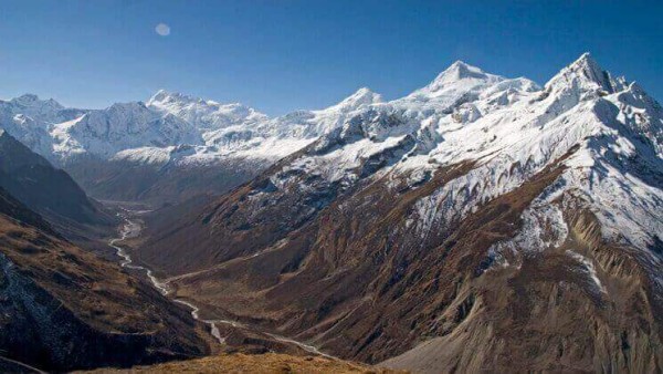
Tucked behind the Manaslu massif, hard against the Tibetan border, sits a valley that most trekkers in Nepal have never even heard of. Tsum Valley wasn't opened to foreign visitors until 2008, and even today it sees a tiny fraction of the traffic that pours through Everest or Annapurna. If you've searched for "Tsum Valley trek distance" or "how many km is the Tsum Valley trek," you've probably noticed the numbers online are all over the place — some sites say 100 km, others say 200+. That's because the "distance" depends on where you start, whether you add side trips, and whether you're counting the road drive, the walking trail, or both.
Table of Contents
This guide breaks all of that down clearly — real distances, real elevation gain, real day-by-day numbers — so you can plan with confidence.
Quick Facts: Tsum Valley Trek at a Glance
| Detail | Figure |
|---|---|
| Region | Manaslu Conservation Area, Gorkha District |
| Total trekking distance (round trip) | ~100–130 km |
| Total distance including road travel | ~280–440 km (varies by route) |
| Duration | 11–16 days (standard); up to 18–20 days with side trips |
| Daily walking distance | 10–20 km / 5–8 hours per day |
| Highest point | Mu Gompa, 3,700 m (side trips reach 4,060–4,200 m) |
| Difficulty | Moderate to strenuous |
| Best seasons | March–May (spring), September–November (autumn) |
| Permits required | Restricted Area Permit (RAP), MCAP, TIMS |
| Status | Restricted area — guide mandatory, no solo trekking |
So, How Far Is the Tsum Valley Trek, Really?
There isn't one single number, because "distance" means three different things depending on how you measure it. Here's the honest breakdown.
1. The Road Distance (Kathmandu to the Trailhead)
The drive from Kathmandu to the trek's starting point — Soti Khola or Machha Khola, in Gorkha district — covers roughly 140 to 160 km on the newer road alignment, taking about 7–9 hours by jeep. On rougher or older route configurations (via Arughat with more unpaved sections), agencies quote closer to 200 km, taking 9–10 hours. Either way, expect a long, bumpy, scenic day that follows the Budhi Gandaki River valley west out of the capital.
2. The Trekking Distance (On Foot)
Once you leave the road behind, the walking trail from Machha Khola up to Mu Gompa — the traditional turnaround point of the Tsum Valley Trek — covers roughly 55 to 65 km one way. Walked as an out-and-back (since Tsum Valley is a dead-end valley with no through-route), that puts the total round-trip trekking distance at approximately 100–130 km, spread across 8–10 walking days. Daily stages typically run 10 to 20 km, or 5 to 8 hours of hiking, with shorter days built in around Chhekampar and Nile for altitude acclimatization.
3. The Combined Total (Road + Trail)
Add the road journey to the trekking distance and a standard Tsum Valley Trek covers somewhere between 280 and 440 km in total, door to door from Kathmandu and back. The wide range comes down to which access route your operator uses and how many rest or exploration days are built into the itinerary.
If You Combine It With the Manaslu Circuit
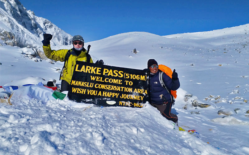
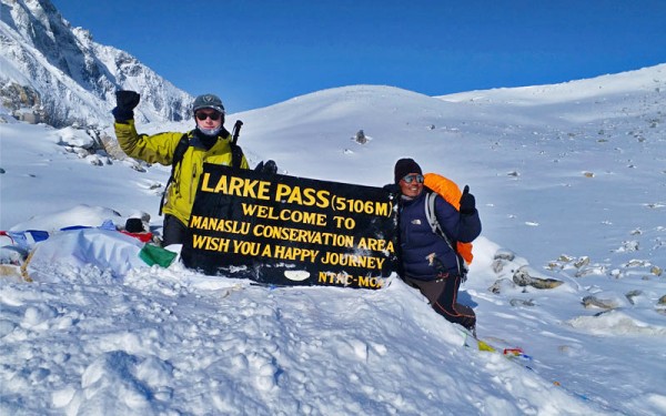
Many trekkers now pair Tsum Valley with the full Manaslu Circuit, crossing the 5,160 m Larkya La pass and exiting into the Annapurna region. That combined route pushes the total walking distance up to approximately 177–240 km over 18–24 days — a very different, much longer expedition than the standalone Tsum Valley trek.
Tsum Valley Trek Itinerary: Day-by-Day Distance Breakdown
Here's what a well-paced 13-day standard itinerary looks like, distance and elevation included. (Mountain Eco Treks can shorten or extend this depending on your fitness level and available time.)
| Day | Route | Approx. Distance | Altitude |
|---|---|---|---|
| 1 | Kathmandu → Machha Khola (drive) | ~150 km | 930 m |
| 2 | Machha Khola → Jagat | ~15 km | 1,340 m |
| 3 | Jagat → Lokpa | ~13 km | 2,240 m |
| 4 | Lokpa → Chumling | ~12 km | 2,386 m |
| 5 | Chumling → Chhekampar (Chhokangparo) | ~13 km | 2,960 m |
| 6 | Chhekampar → Nile / Chhule | ~14 km | 3,361 m |
| 7 | Day hike to Mu Gompa and back | ~10 km round trip | 3,700 m |
| 8 | Nile → Rachen Gompa → Chumling | ~18 km | 2,386 m |
| 9 | Chumling → Lokpa | ~12 km | 2,240 m |
| 10 | Lokpa → Jagat | ~13 km | 1,340 m |
| 11 | Jagat → Machha Khola | ~15 km | 930 m |
| 12 | Machha Khola → Kathmandu (drive) | ~150 km | 1,400 m |
| 13 | Buffer / departure day | — | — |
Add two or three extra days if you want to hike out to Ganesh Himal Base Camp (4,200 m) or the historic Dhephyudonma Gompa (4,060 m) — both worthwhile detours if you have the time and legs for it.
How Difficult Is the Tsum Valley Trek?
Most operators rate the Tsum Valley Trek as moderate to strenuous. You don't need mountaineering skills or ropes, but you do need:
- A reasonable baseline of fitness — 5 to 8 hours of walking a day, several days in a row
- Some prior trekking experience, ideally at altitude
- Comfort with basic teahouse accommodation and cold nights, especially above 3,000 m
- Mental readiness for a remote trail with limited rescue infrastructure compared to Everest or Annapurna
Because the maximum altitude (3,700 m at Mu Gompa, higher with side trips) is enough to trigger altitude sickness in unacclimatized trekkers, the itinerary above is built with gradual ascent and a built-in rest day around Chhekampar/Nile. Don't skip it.
Best Time to Trek Tsum Valley
| Season | Months | Conditions |
|---|---|---|
| Spring | March–May | Rhododendrons blooming, green valleys, clear mountain views |
| Autumn | September–November | Crisp air, stable weather, best overall visibility |
| Shoulder | February, September | Decent conditions, fewer trekkers |
| Monsoon | June–August | Heavy rain, leeches, poor visibility — not recommended |
| Winter | December–January | Very cold, snow-blocked higher trails — generally avoided |
Because Tsum Valley sits partly in the rain shadow of the Himalaya, it stays trekkable even in summer months when other Nepal routes are washed out — a detail worth knowing if you're planning around a fixed travel window.
Tsum Valley Trek Permits and Cost (2026)
Tsum Valley is a restricted area — independent trekking is not legally permitted, and you must trek with a licensed guide from a registered agency. You'll need:
- Manaslu/Tsum Restricted Area Permit (RAP): Roughly USD 100 for the first week in peak season (Sept–Nov), around USD 75 in other months, plus a per-day fee for extensions
- Manaslu Conservation Area Permit (MCAP): Approximately NPR 3,000 (~USD 22–23), valid for the whole trek
- TIMS Card: A modest additional fee, usually arranged by your agency
- If you extend onto the Annapurna side via the full Manaslu Circuit, an ACAP permit is also required
Permit fees change with government policy, so always confirm current rates before booking — this is one of the areas where working with an established local operator like Mountain Eco Treks pays off, since permit processing and paperwork are handled for you.
Why Trek Tsum Valley With Mountain Eco Treks
Tsum Valley isn't a trail you want to figure out on the fly — it's remote, restricted, and thin on infrastructure by design, which is exactly what makes it special. Mountain Eco Treks builds every 9+ Valley itinerary around low-impact, community-based travel: locally owned teahouses, licensed Tsumba and Gurung guides who know the valley from the inside, gradual acclimatization schedules, and permit handling done properly and in advance. Our goal isn't to rush you through the "Hidden Valley of Happiness" — it's to let you actually experience it.
Frequently Asked Questions
How long is the Tsum Valley trek in kilometers?
The round-trip trekking distance is approximately 100–130 km on foot, plus another 280–440 km if you include the road drive from Kathmandu and back.
How many days does the Tsum Valley trek take?
Most itineraries run 11–16 days including the Kathmandu drive on both ends. It can be shortened to around 8 trekking days on the trail itself, or extended to 18+ days with side trips to Ganesh Himal Base Camp.
What is the highest point of the Tsum Valley trek?
Mu Gompa, at 3,700 m, is the highest point on the standard route. Optional side hikes reach Dhephyudonma Gompa (4,060 m) or Ganesh Himal Base Camp (4,200 m).
Is the Tsum Valley trek harder than the Annapurna Circuit?
Not necessarily harder in terms of altitude, but more remote — fewer teahouses, less rescue infrastructure, and a mandatory guide requirement make it feel more committing than well-trodden routes.
Do I need a permit for the Tsum Valley trek?
Yes. You need a Restricted Area Permit (RAP) and a Manaslu Conservation Area Permit (MCAP), both arranged through a licensed trekking agency. Solo, permit-free trekking is not allowed.
What is the best time of year to trek Tsum Valley?
Spring (March–May) and autumn (September–November) offer the most stable weather and clearest mountain views. Tsum Valley's rain-shadow location also makes it more forgiving in the summer monsoon than most other Nepal treks.
Recent From Blog

19th Apr, 2019


23rd Dec, 2018

11th Jan, 2024

14th Jan, 2024

29th Jan, 2025

11th Feb, 2025

18th Feb, 2025

25th Feb, 2025

5th Apr, 2025
23rd Dec, 2025
9th May, 2026
12th Jul, 2026

13th Aug, 2026
13th Aug, 2026
13th Aug, 2026

16th Aug, 2026
20th Aug, 2026


11th Sep, 2026