
The Manaslu Circuit Trek: A Complete Planning Guide
13th Aug, 2026
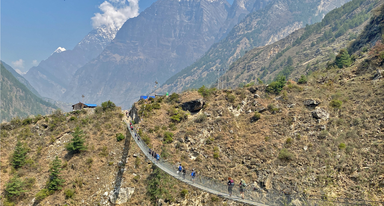
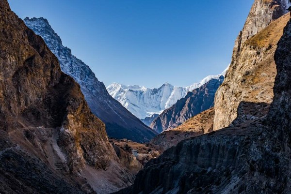
Set apart from the busier trails of Everest and Annapurna is one of Nepal's most rewarding Himalayan journeys. The Manaslu Circuit loops around the base of Mount Manaslu (8,163m), the world's eighth-highest peak, carrying trekkers from the warm lowlands near Machha Khola into a world of glaciers, high alpine passes, and Tibetan-influenced mountain villages.
Table of Contents
What sets Manaslu apart isn't any single viewpoint - it's the overall sense of remoteness. The route has grown steadily more popular in recent years and does see a fair number of trekkers, especially in peak autumn weeks, but traffic on the trail stays well below what you'd find on Everest or Annapurna. Villages here have largely kept their traditional character, and the trail still feels less like a well-trodden tourist route and more like a genuine expedition into the mountains.
We typically recommend 11 to 14 days for this route, giving trekkers enough time to take in the highlights without rushing through the high-altitude stretches.
This guide walks through everything you need before booking: the route itself, distances, a day-by-day itinerary, difficulty level, permit requirements, cost considerations, the best time of year to go, what to pack, and how to manage altitude safely.
Manaslu Circuit Trek at a Glance
| Detail | Information |
|---|---|
| Trek Name | Manaslu Circuit Trek |
| Duration | 11–14 days |
| Starting Point | Machha Khola |
| Trekking Finish | Tilje |
| Road Finish | Besisahar |
| Highest Point | Larkya La Pass – 5,106m |
| Mount Manaslu | 8,163m |
| Difficulty | Strenuous |
| Accommodation | Teahouses and lodges |
| Best Seasons | March–May and September–November |
| Main Valley | Budhi Gandaki Valley |
| Restricted Area | Yes |
| Guide | Mandatory under current restricted-area rules |
| MCAP | NPR 3,000 |
| ACAP | NPR 3,000 |
| Local Government Fee | NPR 1,000 |
| RAP | USD 75–100 for the first 7 days, depending on season |
Why Trek Around Manaslu?
 Something about circling this mountain feels different from other Himalayan routes.
The journey opens at Machha Khola, where the air is warm and the hillsides are green and subtropical. As the trail tracks the Budhi Gandaki River northward, the valley tightens and deepens - waterfalls tumble off the cliffs, suspension bridges span the gorge, and small settlements dot the path.
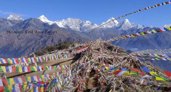
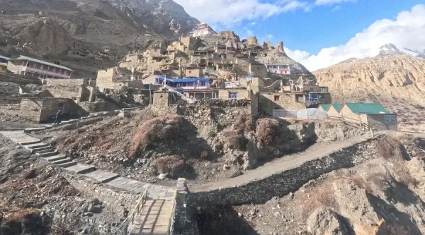
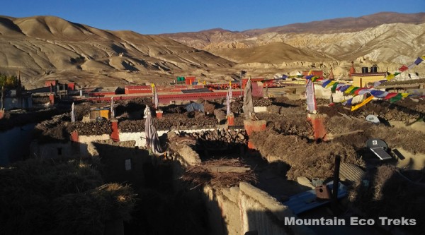
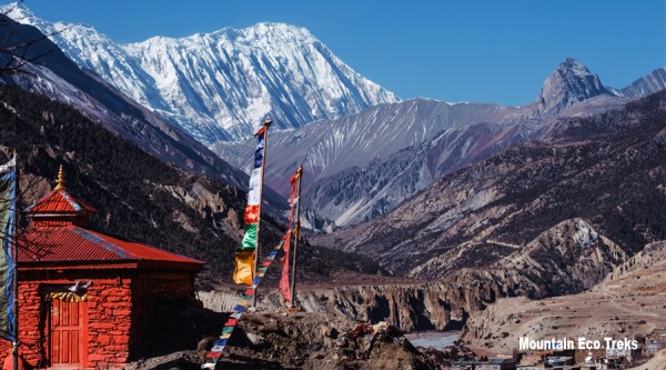
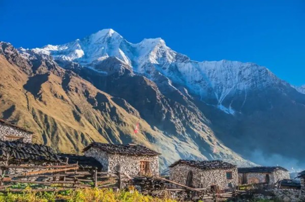
Further along, the character of the trek shifts entirely. Forest gives way to open alpine meadow. Prayer flags start appearing more often. Stone houses replace the lowland architecture, and the mountains begin to take over the skyline.
By the time you reach Shyala and Samagaun, you're standing in the middle of some of the finest mountain scenery Nepal has to offer.
Highlights along the way include:
- Mount Manaslu itself, at 8,163m
- The dramatic gorge cut by the Budhi Gandaki River
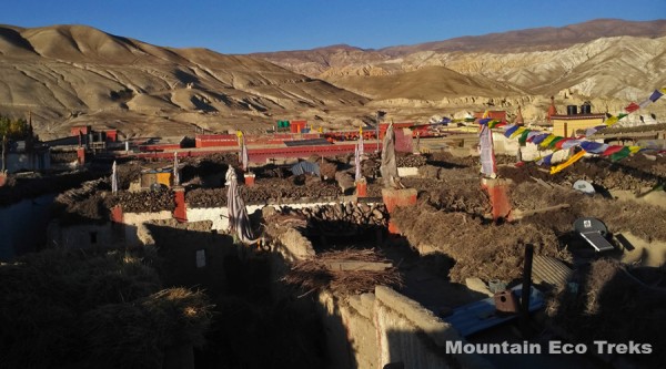
- Traditional villages that have changed little over generations
- Tibetan Buddhist culture and monastic life
- Shyala and Samagaun
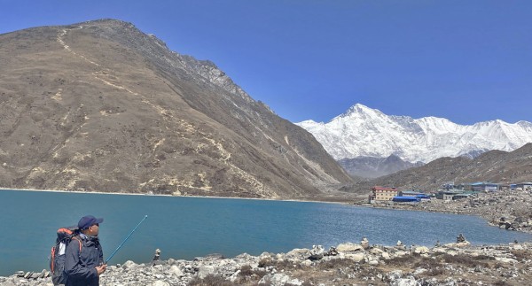
- Birendra Lake
- Manaslu Base Camp
- Samdo and Dharamsala
- Larkya La Pass, at 5,106m
- Bimthang and the mountain panoramas beyond it
- The descent into Tilje and the Marsyangdi Valley
Travelers short on time might consider the Short Manaslu Circuit Trek, which uses transportation more strategically while preserving the trek's key high-altitude sections.
The Route
The Manaslu Circuit is a genuine point-to-point crossing rather than a there-and-back trek.
It begins at Machha Khola and follows the Budhi Gandaki Valley up into the high Himalaya:
Machha Khola → Jagat → Deng → Namrung → Shyala → Samagaun → Samdo → Dharamsala → Larkya La Pass → Bimthang → Tilje → Besisahar
Along the way, the trail moves through several distinct ecological and cultural zones. Lower down, expect forest, farmland, waterfalls, and village life. Higher up, the landscape turns colder and drier, marked by Tibetan-style settlements, monasteries, mani walls, and wide-open mountain pastures.
After Larkya La, the trail drops toward Bimthang before eventually reaching Tilje, where road transport takes over toward Besisahar.
Distance
Total trekking distance depends on your exact itinerary, any side trips you take, and how much of the lower route you cover on foot versus by vehicle.
A full walking itinerary generally covers somewhere between 150 and 177 km. Most days involve 5 to 7 hours of walking, though the day crossing Larkya La runs considerably longer.
The toughest single day on the trek is the crossing from Dharamsala to Larkya La Pass to Bimthang, which can take 8 to 11 hours depending on weather, snow conditions, your acclimatization, and general trail conditions.
Suggested Itinerary
Below is a practical 11-day itinerary. It can easily be stretched to 12–14 days if you'd like more buffer for rest, acclimatization, or unpredictable weather.
Day 1: Machha Khola to Jagat
The trek sets off along the Budhi Gandaki River, weaving through forest, past waterfalls, and across suspension bridges. The setting is still warm and green here, though the mountain atmosphere starts to build the further north you go. The day ends in Jagat.
- Walking time: roughly 6–7 hours
- Overnight: Jagat
Day 2: Jagat to Deng
The valley narrows and grows more dramatic today. Expect more suspension bridges, forest trail, and waterfalls, with the vegetation gradually shifting as elevation increases. Deng is a good staging point before pushing into the higher Manaslu region.
- Walking time: roughly 6–7 hours
- Overnight: Deng
Day 3: Deng to Namrung
Forest and traditional villages continue, but Tibetan cultural influence becomes noticeably stronger - prayer flags, mani walls, chortens, and stone houses appear more frequently. Mountain views also start to open up.
- Walking time: roughly 6–7 hours
- Overnight: Namrung
Day 4: Namrung to Shyala
One of the most beautiful stretches of the entire trek. The trail climbs through pine and rhododendron forest before breaking into a much broader Himalayan landscape. Shyala sits surrounded by towering peaks - a natural place to slow down.
- Walking time: roughly 4–6 hours
- Overnight: Shyala
Day 5: Shyala to Samagaun
The path continues to Samagaun, one of the key villages in the region. The air grows noticeably thinner here, and the terrain feels increasingly alpine. There's no benefit to rushing at this altitude - take it easy.
- Walking time: roughly 4–6 hours
- Overnight: Samagaun
Day 6: Acclimatization Day in Samagaun
A rest day here is well worth building into your schedule. Rather than gaining elevation, you stay at the same altitude and use the day to explore nearby options:
- Birendra Lake - an accessible, rewarding acclimatization hike
- Manaslu Base Camp - longer and more demanding, with outstanding views
- Pungyen Gompa - a culturally rich hike with strong mountain scenery
Or simply take it slow and explore Samagaun itself. This extra day tends to pay off significantly once you reach the higher stretches of the trek.
- Overnight: Samagaun
Day 7: Samagaun to Samdo
The terrain turns more rugged as tree cover thins out and the landscape becomes high alpine. Samdo is among the highest villages on the circuit, sitting close to the Tibetan border area. Keep a slow, steady pace given the altitude.
- Walking time: roughly 3–4 hours
- Overnight: Samdo
Day 8: Samdo to Dharamsala
A deliberately short day. You arrive at Dharamsala (also called Larke Phedi), your final stop before Larkya La. Use the afternoon to prepare - check your gear, pack your day bag, stay hydrated, and rest as much as possible.
- Walking time: roughly 3–4 hours
- Overnight: Dharamsala
Day 9: Dharamsala to Bimthang via Larkya La Pass
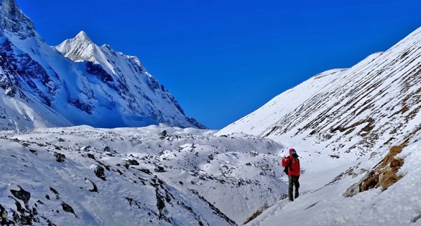
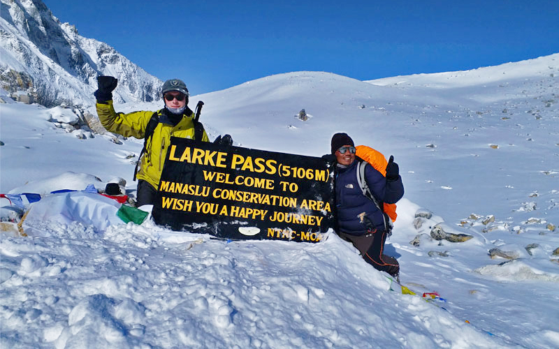
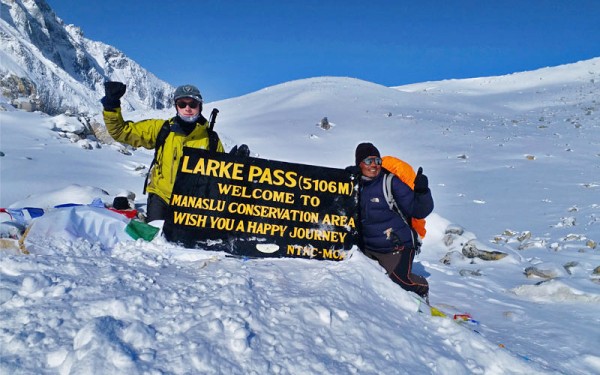
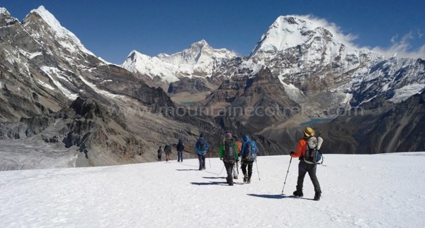
The most demanding day of the trek. Most groups start well before sunrise. The climb to Larkya La is gradual but physically taxing thanks to the altitude, cold, wind, snow, and rough terrain. Reaching the prayer flags at the 5,106m summit is a genuine milestone. From there, a long descent leads down toward Bimthang - hard on tired legs, but the scenery makes it worthwhile.
- Walking time: roughly 8–11 hours
- Highest point: 5,106m
- Overnight: Bimthang
Day 10: Bimthang to Tilje
After Larkya La, the trail feels far more forgiving. You descend through forest into greener, warmer terrain, a welcome change after the high pass. Tilje marks the practical end of the main trekking route.
- Walking time: roughly 5–7 hours
- Overnight: Tilje
Day 11: Tilje to Besisahar
The trekking portion ends here, and the journey continues by road. Depending on conditions and your arrangements, you'll travel from Tilje to Besisahar, and from there onward to Kathmandu or your next destination.
- Transport: Jeep/road transfer
- Destination: Besisahar
Why Consider 12–14 Days Instead of 11?
An 11-day itinerary is achievable for fit, experienced trekkers comfortable with long days and efficient logistics. That said, a few extra days can make a meaningful difference in comfort and safety. A 12–14 day version leaves room for:
- Better acclimatization
- Weather delays
- Rest days
- Photography
- Village exploration
- Side trips
- A more relaxed pace
- Unexpected trail conditions
Mountain weather doesn't follow a schedule, and having a spare day or two - particularly around Larkya La - can prove genuinely valuable.
How Hard Is the Manaslu Circuit?
This is classified as a strenuous, high-altitude trek. No technical mountaineering skills are required, but solid physical fitness and mental readiness matter a great deal.
The main challenges:
- Long trekking days
- High altitude
- Steep climbs
- Rocky, uneven descents
- Cold temperatures
- The Larkya La crossing itself
Most days involve 5–7 hours of walking; the Larkya La day is the notable exception at 8–11 hours.
If you're training beforehand, prioritize endurance over raw strength. Regular hiking, stair climbing, hill walking, running, cycling, and general strength work all help. You don't need to be an elite athlete - just someone comfortable walking for multiple consecutive days. If the full walking schedule feels daunting, the Short Manaslu Circuit Trek offers a lighter alternative while still crossing the high pass.
Best Time to Go

Spring and autumn are generally the strongest windows for this trek. The Nepal Tourism Board also lists March–May and September–November as the recommended seasons for the Manaslu Conservation Area.
Autumn (September–November): The most popular season. The monsoon has typically cleared out, visibility tends to be excellent, and conditions around the high pass are usually favorable. October and November see the most traffic.
Spring (March–May): Warmer temperatures and blooming rhododendron forests make this a beautiful time to trek, particularly in the lower and middle sections. April and May stand out.
Winter (December–February): Possible for experienced trekkers, but snow and freezing conditions can make crossing Larkya La significantly harder. Heavy snowfall can also affect the availability of high-altitude lodging.
Monsoon (June–August): Generally the least favorable window. Expect heavy rain, landslide risk, muddy trails, leeches, obscured mountain views, and disrupted road access.
These seasonal windows apply equally to the Manaslu Circuit Trek and the Short Manaslu Circuit Trek, since both follow the same core route through the high pass.
Permits and Fees
Manaslu is a restricted trekking region, so beyond the standard conservation-area permits, trekkers need additional authorization. According to Nepal's Department of Immigration, the Manaslu Restricted Area Permit currently runs USD 100 for the first week during September–November, and USD 75 for the first week from December through August, with extra daily fees beyond the first seven days.
| Permit / Fee | Current Cost |
|---|---|
| Manaslu Restricted Area Permit (Sept–Nov) | USD 100 for the first 7 days |
| Additional RAP (Sept–Nov) | USD 15/day after day 7 |
| Manaslu Restricted Area Permit (Dec–Aug) | USD 75 for the first 7 days |
| Additional RAP (Dec–Aug) | USD 10/day after day 7 |
| Manaslu Conservation Area Permit (MCAP) | NPR 3,000 |
| Annapurna Conservation Area Permit (ACAP) | NPR 3,000 |
| Local Government / Entry Fee | NPR 1,000 |
| TIMS | See note below |
The MCAP and ACAP fees sit outside the Restricted Area Permit, so budget for them separately.
Worked example: A 14-day restricted-area section during September–November would break down as:
- First 7 days: USD 100
- Following 7 days: USD 105
- RAP total: USD 205
Add on MCAP (NPR 3,000), ACAP (NPR 3,000), and the local government fee (NPR 1,000), and the known permit and local-fee total for that example comes to USD 205 plus NPR 7,000.
Permit rules do shift over time, so we always confirm the exact figures for your specific departure date before issuing paperwork.
Do You Need a TIMS Card?
No. The Manaslu Circuit does not require a TIMS Card on any route variation. Because this is a restricted area, the Restricted Area Permit already performs the tracking function that TIMS handles elsewhere in Nepal, so no separate card is issued.
What Manaslu does require is a licensed guide and booking through a government-registered trekking agency. Independent, guideless trekking isn't an option here - checkpoints along the way, starting at Jagat, verify both your guide's credentials and your permits.
In short: skip the TIMS card, but plan on a licensed guide and a registered agency - there's no way around either requirement.
We handle the Restricted Area Permit, MCAP, ACAP, and your licensed guide as a single package, since these can't be arranged independently and the underlying regulations are updated periodically by the Nepal Tourism Board and Department of Immigration.
Cost Considerations
Total trip cost varies with season, group size, accommodation standard, transportation, and how much support (guide, porter) you bring along.
A well-built Manaslu package typically covers:
- Restricted Area Permit
- Manaslu Conservation Area Permit
- Annapurna Conservation Area Permit
- Local government fee
- Guide
- Porter, if requested
- Teahouse accommodation
- Meals on trek
- Transportation
- Permit processing
- Agency support and trip arrangement
Budget separately for:
- Nepal visa
- International flights
- Travel insurance
- Personal gear
- Snacks and drinks
- Hot showers, charging, Wi-Fi
- Tips
- Other personal spending
When comparing quotes, resist choosing the cheapest option purely on price. On a high-altitude trek like this, a capable guide, sound itinerary, proper acclimatization schedule, reliable transport, and solid emergency support matter far more than shaving a few dollars off the total.
For travelers weighing budget against time, it's worth comparing the full Manaslu Circuit Trek against the Short Manaslu Circuit Trek and the Short Annapurna Circuit Trek side by side - each has a different balance of cost, duration, and trail experience.
What to Pack
Manaslu crosses several climate zones, so your kit needs to handle both warm lowland conditions and freezing high-altitude weather.
Clothing
- Thermal base layers
- Fleece jacket
- Down jacket
- Waterproof, windproof shell
- Trekking trousers
- Thermal trousers
- Warm hat and sun hat
- Gloves
- Warm trekking socks
Gear
- Broken-in trekking boots
- Trekking poles
- Sleeping bag
- Daypack and duffel bag
- Headlamp
- Water bottle or hydration bladder
- Water purification (tablets or filter)
- Sunglasses, sunscreen, lip balm
Personal Items
- Passport
- Travel insurance documents
- Personal medication and basic first-aid supplies
- Power bank
- Cash
- Permit copies
Pack light where you can - a lighter bag makes the long climbs noticeably more manageable.
Altitude Safety
Altitude deserves serious respect on this trek. You'll start at relatively low elevation and end up crossing Larkya La at 5,106m.
Watch for symptoms such as:
- Headache
- Nausea
- Dizziness
- Unusual fatigue
- Loss of appetite
- Trouble sleeping
- Shortness of breath
Tell your guide the moment symptoms appear - don't downplay them out of concern for slowing the group down. A well-designed itinerary builds in the time your body needs to adjust.
Stay hydrated, eat consistently, skip alcohol at altitude, and follow your guide's judgment. We also strongly recommend travel insurance that specifically covers high-altitude trekking and emergency evacuation.
Manaslu vs. the Short Annapurna Circuit Trek
Both routes deliver outstanding Himalayan scenery, but the experiences differ quite a bit.
Manaslu suits travelers after a more remote journey with a strong Tibetan cultural thread running through it. It has become busier in recent seasons, particularly in October and November, but it still sees noticeably fewer trekkers than the Annapurna region. The Short Annapurna Circuit, by contrast, offers dramatic scenery and traditional villages within a more developed infrastructure, simpler logistics, and a considerably higher volume of foot traffic.
| Feature | Manaslu Circuit | Short Annapurna Circuit |
|---|---|---|
| Atmosphere | Remote, moderately busy | More developed, busier |
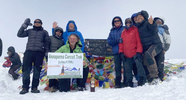
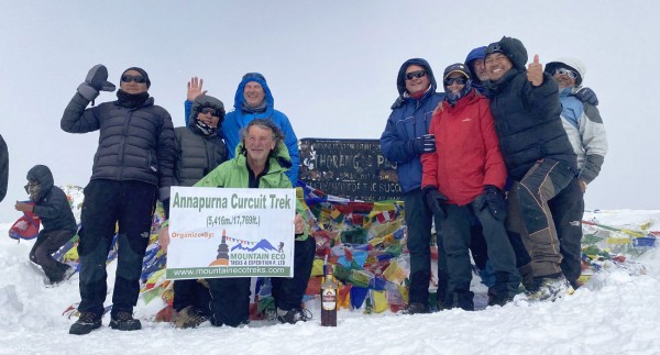
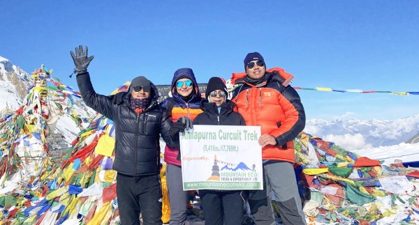
| Highest Pass | Larkya La – 5,106m | Thorong La – 5,416m |
| Culture | Strong Tibetan influence | Highly diverse |
| Road Access | Limited | More extensive |
| Accommodation | Basic teahouses | Wider choice |
| Logistics | More involved | Generally simpler |
| Crowds | Moderate, growing | Heavier |
| Wilderness Feel | Excellent | Moderate to high |
| Adventure Level | High | High |
If remoteness, traditional villages, and lighter trail traffic matter most to you, Manaslu is the stronger pick. If you'd rather keep logistics simple and the trip shorter, consider the Short Annapurna Circuit instead.
Adding Tsum Valley
Yes, this is a popular option. Tsum Valley is known for its ancient Buddhist monasteries, traditional settlements, deep Tibetan cultural heritage, and peaceful setting.
It requires extra days and a separate permit. For an 11–14 day trip, we generally suggest sticking with the main circuit unless you have additional time available - but if a longer cultural journey appeals to you, pairing Tsum Valley with Manaslu is well worth considering.
Frequently Asked Questions
How many days does the Manaslu Circuit take? Typically 11–14 days, depending on itinerary, pace, acclimatization needs, transport, and weather.
Where does the trek start and finish? It begins at Machha Khola and finishes (for trekking purposes) at Tilje, followed by a road transfer to Besisahar.
What's the highest point? Larkya La Pass, at 5,106 meters (16,752 feet).
Is it a difficult trek? Yes - it's a strenuous, high-altitude trek, and the Larkya La crossing is the main challenge.
How far do you walk in total? Generally 150–177 km for a full walking itinerary, though side trips and road use can change this.
Do I need a guide? Yes. Manaslu is a restricted region and must be arranged according to current government rules.
Can beginners do this trek? Yes, though it isn't a beginner-friendly route. Good fitness, careful acclimatization, and an experienced guide are essential.
What's the best month to go? October and November are the busiest and most popular; April and May are also excellent.
Can I trek in winter? Yes, but snow and freezing conditions can make crossing Larkya La significantly harder.
Can Tsum Valley be added? Yes, provided you have the time and obtain the additional required permit.
What permits are needed? The Manaslu Restricted Area Permit, Manaslu Conservation Area Permit, Annapurna Conservation Area Permit, and local government fee. TIMS is not required for this route - confirm current regulations before departure, as rules can change.
What's the difference between the Manaslu Circuit Trek and the Short Manaslu Circuit Trek? Both cover the same core route and the Larkya La crossing. The Short Manaslu Circuit Trek simply uses transportation more strategically on the lower sections, trimming a few walking days for travelers with less time available.
Is the Manaslu Circuit Trek harder than the Short Annapurna Circuit Trek? They're comparable in difficulty, though the Short Annapurna Circuit Trek crosses a slightly higher pass (Thorong La at 5,416m) and generally offers easier logistics and more developed infrastructure along the way.
Is the Manaslu Circuit Worth It?
For the right kind of traveler, without question.
This isn't a trek built around one famous viewpoint - it's about the accumulation of small moments along the way: waking up in a quiet mountain village, crossing a swaying bridge over the Budhi Gandaki, walking past centuries-old mani walls, and watching the landscape transform, day by day, as you climb higher.
Then there's Larkya La itself. After days of steady effort, standing at 5,106 meters surrounded by some of the most striking scenery in the Himalayas is something few other treks can match. The descent through Bimthang and into Tilje offers yet another shift in landscape before the road eventually takes over.
If you're after a Himalayan trek that blends mountains, culture, adventure, remote villages, and a serious high-altitude pass, the Manaslu Circuit belongs near the top of the list. Short on time? The Short Manaslu Circuit Trek delivers the essential highlights in a more compact itinerary. And if you're weighing Manaslu against another classic route, the Short Annapurna Circuit Trek is worth a look too.
Plan Your Trek
 The Himalayas are about far more than reaching a final destination - they're about everything in between: the villages, the suspension bridges, the mountain mornings, the tea breaks, the shifting landscapes, and the people you meet along the way.
We build trekking experiences around being practical, safe, comfortable, and genuinely enjoyable. Whether you choose the full Manaslu Circuit, the Short Manaslu Circuit, or want to compare it against the Short Annapurna Circuit, our team is here to help you find the itinerary that fits your time, experience level, and travel style.
Recent From Blog

19th Apr, 2019


23rd Dec, 2018

11th Jan, 2024

14th Jan, 2024

29th Jan, 2025

11th Feb, 2025

18th Feb, 2025

25th Feb, 2025

5th Apr, 2025
23rd Dec, 2025
9th May, 2026
12th Jul, 2026

13th Aug, 2026
13th Aug, 2026
13th Aug, 2026

16th Aug, 2026
20th Aug, 2026


11th Sep, 2026
24th Sep, 2026