
Larkya La Pass (5,160m): Difficulty, Crossing Time & Preparation
14th Oct, 2026
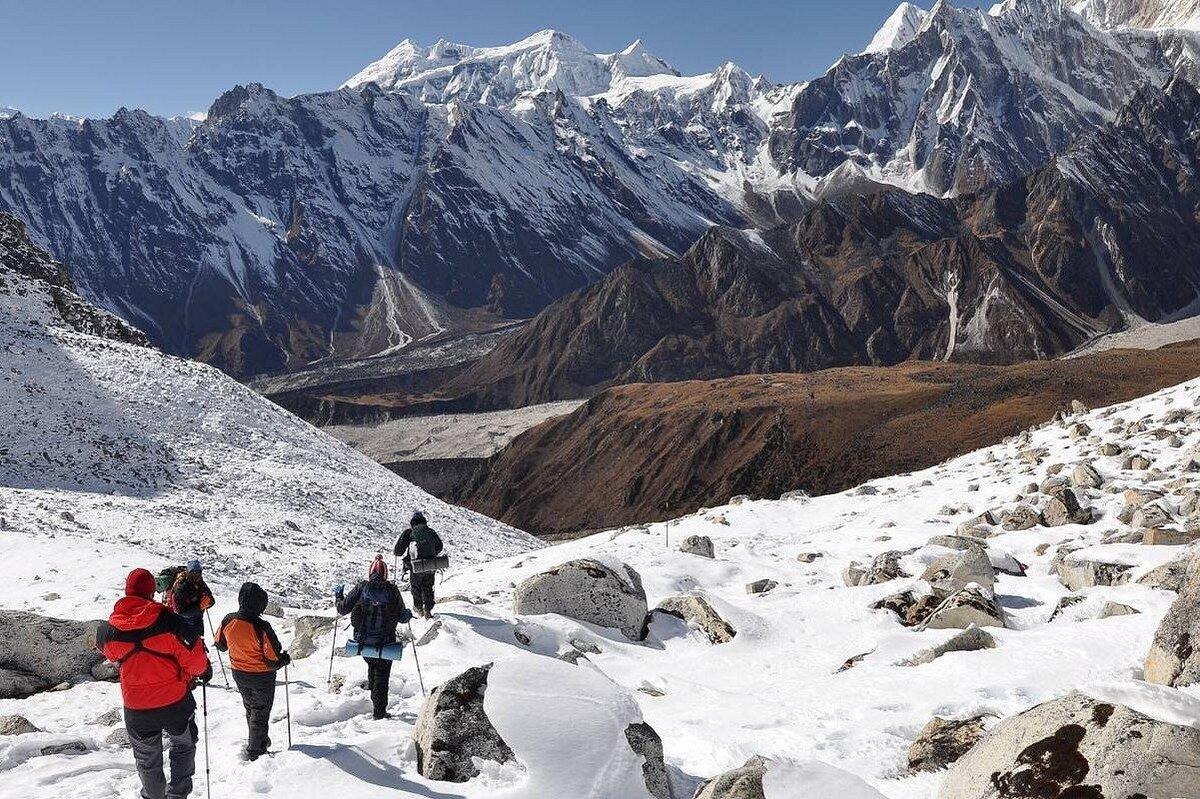
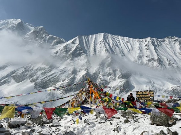
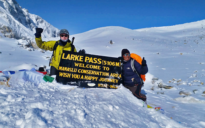
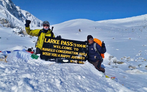
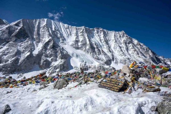
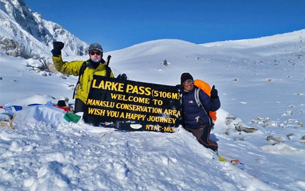
There is a moment on the Manaslu Circuit that every trekker remembers. It is still dark, your headlamp throws a small circle of light on the frozen trail, and your breath hangs in the air. Hours later the slope eases, the first prayer flags snap in the wind, and suddenly a wall of white peaks opens up in front of you. You have reached Larkya La Pass.
Table of Contents
At 5,160 m (about 16,930 ft), Larkya La is the highest point of the Manaslu Circuit and the day that decides the trek. It is demanding, but it is not technical. With the right fitness, pacing and acclimatization, most healthy trekkers cross it safely. This guide covers everything you need to know about Larkya La Pass difficulty, crossing time, weather and preparation, based on the day plan we follow on our Short Manaslu Circuit Trek.
Larkya La Pass at a glance
| Detail | Information |
|---|---|
| Altitude | About 5,160 m (often listed as 5,106 m or 5,135 m, depending on the source) |
| Region | Manaslu Conservation Area, Gorkha and Manang districts |
| Pass day starts at | Dharmasala (Larkya Base Camp), 4,460 m |
| Pass day ends at | Bimthang, about 3,720 m |
| Distance on pass day | About 16 km |
| Walking time | About 8 to 9 hours (start between 3:00 and 4:00 AM) |
| Ascent / descent | About 700 m up, about 1,440 m down |
| Difficulty | Moderate to challenging, non-technical |
| Best seasons | March to May and September to November |
| Technical gear | Not needed in normal conditions, though microspikes help when icy |
What Is Larkya La Pass?
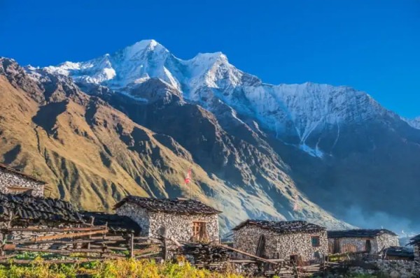
Larkya La (also written Larke La) is a high Himalayan pass that connects the Budhi Gandaki valley on the Manaslu side with the Bimthang valley on the Annapurna side. For centuries traders and herders used this crossing to move between the two regions.
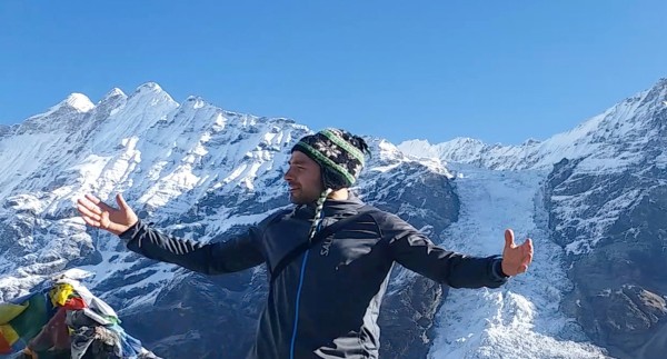
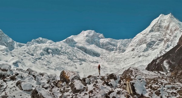
It is the dramatic centerpiece of the Manaslu Circuit, the trek that loops around the world's eighth-highest mountain, Manaslu (8,163 m). From the top you see a sweeping panorama of Manaslu, Annapurna II, Himlung Himal, Cheo Himal and Kang Guru, along with glaciers, moraines and a sea of ridgelines.
Our Short Manaslu Circuit Trek is built entirely around making this crossing safe and well-paced. You can read the full route on the trip page and see our other Manaslu region treks.
A Note on the Altitude
If you search online, you will find Larkya La listed at 5,106 m, 5,135 m and 5,160 m. This is normal. Different surveys, GPS devices and maps give slightly different figures, and the top of the pass is a broad ridge rather than a single point. Throughout this guide we use 5,160 m, which is the most commonly quoted height. Whichever number you see, the effect on your body is the same: you will be well above 5,000 m, where the air holds roughly half the oxygen of sea level.
How Difficult Is Larkya La Pass?
Short answer: Larkya La is a moderate to challenging pass. It is not technical, so you do not need ropes, crampons or climbing skills in normal conditions. What makes it hard is the combination of altitude, distance, cold and an early start.
Here is what drives the difficulty.
1. Altitude
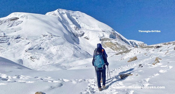
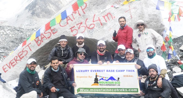
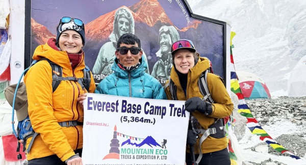
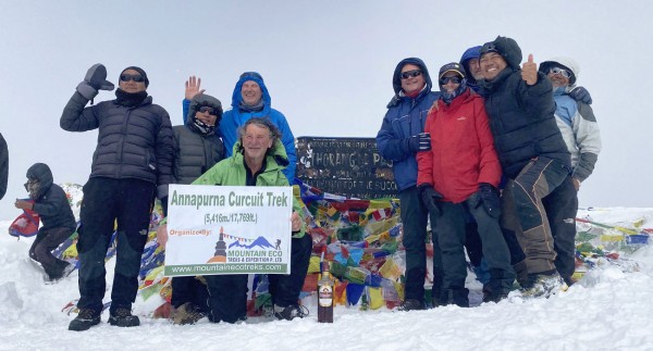
The pass tops 5,000 m, which is higher than Everest Base Camp (5,364 m is similar) and close to the level of Thorong La on the Annapurna Circuit (5,416 m). Mild altitude symptoms such as breathlessness, headache and loss of appetite are common on this day. The trek itself is built to give your body time to adjust. See our full guide to Manaslu difficulty for the bigger picture.
2. A Very Long Day
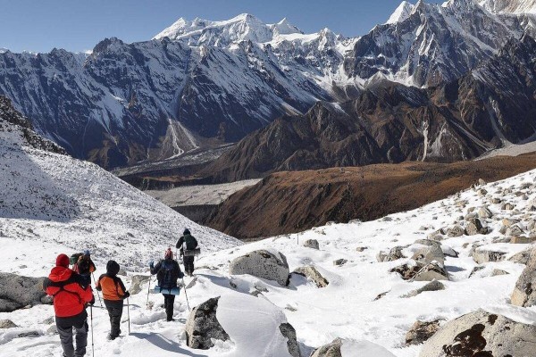
Pass day is the longest of the whole trek. You walk about 16 km in 8 to 9 hours, climbing roughly 700 m and then descending about 1,440 m to Bimthang. The descent is harder on the knees than most people expect, and it comes after hours of effort at altitude.
3. Cold and Wind
You start in the dark, in temperatures that can be well below freezing, and the wind tends to rise by late morning. Gloves, a proper hat and a windproof layer are not optional.
4. Terrain
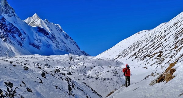
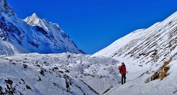
The trail crosses rocky moraine, loose stones and, in cold seasons, patches of snow and ice. The path is clear but uneven, and the final climb is steady rather than steep.
5. Weather Sensitivity
This is a high pass, so fresh snow or strong wind can delay or close it. Your guide makes the final call on the day.
Difficulty rating summary
| Factor | Rating |
|---|---|
| Technical difficulty | Low |
| Altitude | High |
| Distance and duration | High |
| Cold exposure | High |
| Steepness | Moderate |
| Overall | Moderate to challenging |
Who can do it? Healthy beginners with good fitness and a few months of training can complete it, especially on a well-paced itinerary with acclimatization days. That said, we do not recommend it as a very first trek, and prior experience at altitude (for example Poon Hill, Langtang or Everest View) is a real advantage.
Larkya La Pass Crossing Time: Hour by Hour
Crossing time depends on your pace, the season and trail conditions, but a typical day looks like this.
| Time | What happens |
|---|---|
| 2:30 to 3:00 AM | Wake up at Dharmasala, hot tea and breakfast |
| 3:30 to 4:00 AM | Start walking by headlamp |
| 5:30 to 6:00 AM | Sunrise colors on the peaks, first rest stop |
| 7:30 to 9:00 AM | Reach the top of the pass (4 to 5 hours of climbing) |
| 9:00 AM | Photos, prayer flags, a short rest (keep it brief because it is cold) |
| 9:15 AM to 1:00 PM | Long descent over moraine and into the valley |
| 1:00 to 2:00 PM | Lunch stop and continue down |
| 3:00 to 4:00 PM | Arrive at Bimthang, rest and warm up |
Quick numbers
- Dharmasala to the pass: about 4 to 5 hours
- Pass to Bimthang: about 4 to 5 hours
- Total pass day: about 8 to 9 hours, sometimes up to 10 in snow or for slower walkers
Your guide sets the pace. The goal is to reach the top before the afternoon wind and descend to lower altitude with plenty of daylight to spare.
The Route Before and After the Pass
Larkya La is the climax, but how you prepare matters as much as the crossing itself. This is the progression in our 11-day itinerary.
| Day | Route | Altitude | Walking time |
|---|---|---|---|
| 1 | Drive Kathmandu to Machha Khola | about 900 m | 8 hrs drive |
| 2 | Machha Khola to Jagat | 1,410 m | 6 to 7 hrs |
| 3 | Jagat to Deng via Philim | 1,800 m | 6 to 7 hrs |
| 4 | Deng to Namrung | 2,630 m | 5 to 6 hrs |
| 5 | Namrung to Sama Gaon via Lho | 3,530 m | 7 to 8 hrs |
| 6 | Acclimatization day at Sama Gaon | 3,530 m | Optional hike |
| 7 | Sama Gaon to Samdo | 3,860 m | 4 to 5 hrs |
| 8 | Samdo to Dharmasala | 4,460 m | 4 to 5 hrs |
| 9 | Cross Larkya La Pass to Bimthang | 5,160 m, then 3,720 m | 8 to 9 hrs |
| 10 | Bimthang to Tilje | 2,300 m | 6 to 7 hrs |
| 11 | Drive Tilje to Kathmandu | 1,400 m | 8 to 9 hrs drive |
Notice the slow, steady gain from Namrung to Samdo to Dharmasala, with a full rest day at Sama Gaon. That structure, not luck, is what gets most trekkers across the pass comfortably. Each day above 3,000 m, we also monitor oxygen saturation and pulse so we can spot trouble early.
If you want a more relaxed schedule with extra acclimatization days, ask us about the full-length Manaslu Circuit Trek, or combine the circuit with the Tsum Valley Trek for a deeper cultural journey.
Altitude Sickness on Larkya La: What to Know
At more than 5,000 m, acute mountain sickness (AMS) is a real risk for anyone, regardless of age or fitness. Fit trekkers can be affected and some less fit trekkers are fine, which is why a gradual ascent is so important.
Common early signs
- Headache that does not ease
- Nausea or loss of appetite
- Dizziness or unusual fatigue
- Poor sleep and shortness of breath at rest
What helps
- Ascend gradually, following the planned itinerary and not racing ahead
- Drink plenty of water, typically 3 to 4 liters a day
- Avoid alcohol and sleeping pills at altitude
- Eat even when you are not hungry, since energy supports acclimatization
- Tell your guide early if you feel unwell
- Descend if symptoms worsen, which is the most effective treatment
Severe warning signs include confusion, loss of coordination, a persistent cough with breathlessness, or a headache with vomiting. These require immediate descent and medical help. Our guides carry a first aid kit and check oxygen levels, but the decision to turn back is always taken in the interest of your safety.
Some trekkers choose to take preventive medication. Speak to your own doctor well before you travel, because it is a personal medical decision.
Weather, Snow and Best Season for Larkya La
The pass is open only when conditions are safe, so season matters.
| Season | Months | Conditions on the pass |
|---|---|---|
| Autumn | September to November | The most stable weather, clear skies, October is best |
| Spring | March to May | Warmer, clear mornings, rhododendrons lower down |
| Winter | December to February | Cold, heavy snow, the pass may close |
| Monsoon | June to August | Rain, landslides on the lower trail, poor views |
Our fixed departures run from October 2026 through May 2027. The winter dates are subject to snow conditions on the pass, so please contact us before booking a December to February departure. For more detail, read our guide to the best time for the Short Manaslu Circuit Trek.
What if the pass is closed? Fresh snow, whiteout or high winds can delay the crossing. Because of that we recommend keeping one or two spare days in your overall Nepal plans, and your guide will advise whether to wait at Dharmasala or Samdo for conditions to improve.
How to Prepare for Larkya La Pass
Physical training (8 to 12 weeks)
- Cardio 3 to 4 times a week: brisk walking, hiking, cycling, running or swimming
- Hill or stair training with a loaded pack: build up to 6 to 8 hours of hiking with a daypack
- Leg strength: squats, lunges and step-ups to protect your knees on the long descent
- Core and balance: planks and single-leg work for rocky trails
- Back-to-back hiking days to practice walking tired
Mental preparation
The day starts in the dark and feels long. Break it into small goals: the next rest stop, the next prayer flag, the next hour. Most trekkers say the mental side is as important as the physical.
Practical preparation
- Break in your boots well before you travel
- Practice with trekking poles, which take a lot of load off knees during the descent
- Get travel insurance that covers trekking up to at least 5,500 m and emergency helicopter evacuation, since the pass is above 5,000 m
- Arrive in Kathmandu a day early to rest and get your permits organized
Larkya La Pass Packing List
Most of your kit is the same as for any high trek, but a few items matter much more on pass day.
Clothing
| Item | Why it matters |
|---|---|
| Down jacket (warm, windproof) | Essential in the pre-dawn cold |
| Thermal base layers | Top and bottom for early start |
| Fleece or mid-layer | Easy to add or remove |
| Waterproof, windproof shell | Protects against wind and snow |
| Warm hat and buff | Covers head, ears and face |
| Insulated gloves (with liner gloves) | Fingers get very cold at altitude |
| Wool socks (3 to 4 pairs) | Keeps feet warm and dry |
Footwear and gear
| Item | Why it matters |
|---|---|
| Waterproof trekking boots | Ankle support on rocky moraine |
| Gaiters (optional) | Keeps snow out of boots |
| Microspikes (optional, season dependent) | Useful if the trail is icy |
| Trekking poles | Essential for the descent |
| Headlamp with spare batteries | You start walking in the dark |
| Sunglasses (UV400) and sunscreen SPF 50+ | Strong glare from snow |
| Water bottle or insulated flask | Prevents freezing |
| Sleeping bag rated for about -10°C | Cold nights at Dharmasala and Samdo |
Health and extras
- Personal medication and a small first aid kit
- Lip balm with SPF
- Energy bars, nuts and electrolyte powder
- Power bank (batteries drain quickly in the cold)
Our standard package includes a down sleeping bag, down jacket and duffle bag on request, so you do not need to buy expensive gear for a single trip. For the complete list, see the packing checklist on our Short Manaslu Circuit Trek page, and our essential tips for first-time trekkers.
Permits and Rules for the Manaslu Region
Larkya La lies inside a restricted area, so you cannot cross it independently. Three permits are required:
- Manaslu Restricted Area Permit (RAP)
- Manaslu Conservation Area Permit (MCAP)
- Annapurna Conservation Area Permit (ACAP), because the trek exits through the Annapurna region
A government-licensed guide is mandatory, and permits must be arranged through a registered trekking agency in Kathmandu. As an example, the RAP costs about USD 100 for the first seven days and USD 15 per extra day from September to November, and USD 75 plus USD 10 per extra day from December to August. MCAP and ACAP are about USD 20 each, and a local municipality fee applies. Fees can change, so always confirm current rates before you travel.
All permits are included in our packages. For the full breakdown, read our Short Manaslu Circuit Trek permits and cost guide.
Package Options and Pricing
Our 11-day Short Manaslu Circuit Trek is available in two plans:
| Plan | Price (per person) | Highlights |
|---|---|---|
| Standard | US$1,485 | Private transport, 2 nights in a 3-star Kathmandu hotel, shared porter, all permits, guide, meals on trek |
| Budget | US$1,050 | Public transport, guide, all permits, meals and teahouses on trek (porter and private transport on request) |
Both plans include the licensed guide, permits, teahouse accommodation, three meals a day on trek, safe drinking water, a local SIM card, oximeter checks, first aid support and a welcome dinner. Prices and inclusions can change, so check the current details on the trip page.
Tips for a Safe and Strong Pass Day
- Sleep as well as you can at Dharmasala, and drink water in the evening.
- Eat a proper breakfast, even if you are not hungry, because you will burn a lot of energy.
- Start slowly. The first hour should feel almost too easy.
- Use the rest-step method: short pauses and steady breathing.
- Layer smartly. You will be cold at the start and warm by mid-morning.
- Keep snacks and water within reach, not in the bottom of your pack.
- Do not linger on top. Take your photos and start descending.
- Protect your knees with poles and shorter steps on the descent.
- Stay with your guide. If conditions change, the decision to continue, wait or turn back is shared and safety-first.
- Celebrate in Bimthang, where the alpine meadows and the view back toward Manaslu's south face are a fitting reward.
Larkya La vs Other High Passes
| Pass | Altitude | Trek | Notes |
|---|---|---|---|
| Larkya La | About 5,160 m | Manaslu Circuit | Long day, non-technical, fewer trekkers |
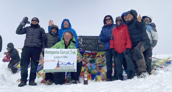
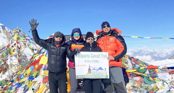
| Thorong La | 5,416 m | Annapurna Circuit | Busier, often compared with Larkya La |
| Cho La | 5,420 m | Everest Three High Passes | Glacier crossing, more technical |
If you are weighing treks, compare the Short Annapurna Circuit Trek or the Everest Three High Passes Trek. Many trekkers choose Manaslu for its quieter trails and strong cultural character.
Why Cross Larkya La with Mountain Eco Treks?
Mountain Eco Treks is a licensed, locally owned trekking company based in Kathmandu, founded by mountain leader Ram Bahadur Tamang, who has more than 15 years of experience guiding in Nepal and Tibet. We are registered with the Nepal Tourism Board and TAAN, and our guides are government-licensed and first aid trained.
On pass day that means:
- Experienced pacing and decision-making from guides who know this crossing well
- Daily oxygen and pulse checks using an oximeter
- Built-in acclimatization at Sama Gaon and gradual altitude gain
- Permits, transport and logistics handled for you
- Small groups and personal attention, including solo travelers on group departures
Read what other trekkers say on our testimonials page, and see why choose us.
Top 15 FAQs About Larkya La Pass
1. How high is Larkya La Pass?
Larkya La is about 5,160 m (16,930 ft), though some sources list it as 5,106 m or 5,135 m. It is the highest point on the Manaslu Circuit.
2. How hard is Larkya La Pass?
It is moderate to challenging. The pass is non-technical, but the altitude, the long day of 8 to 9 hours, the cold and the early start make it demanding. With good fitness and proper acclimatization, most healthy trekkers can complete it.
3. How long does it take to cross Larkya La Pass?
The full day from Dharmasala to Bimthang takes about 8 to 9 hours. The climb to the top takes about 4 to 5 hours, and the descent takes another 4 to 5 hours. In snow or at a slow pace it can take up to 10 hours.
4. What time do you start crossing Larkya La?
Most groups start between 3:00 and 4:00 AM so they reach the top in the morning, before the wind rises, and have enough daylight to descend safely.
5. Is Larkya La Pass dangerous?
It is not technically dangerous in normal conditions, but the risks are altitude sickness, cold, wind, fresh snow and fatigue. These are reduced by a gradual ascent, early start, proper gear and an experienced guide.
6. Do I need technical equipment like crampons or ropes?
No, not in normal conditions. Trekking poles are strongly recommended, and microspikes or gaiters can help if the trail is icy or snowy in colder months.
7. When is the best time to cross Larkya La Pass?
Autumn (September to November) and spring (March to May) are best. October offers the most stable weather and clearest views. Winter brings heavy snow that may close the pass, and the monsoon brings rain and landslides on lower trails.
8. Can beginners cross Larkya La Pass?
Fit beginners can, with preparation and a well-paced itinerary. It is not ideal as a very first trek, so prior experience at altitude helps. Train for 8 to 12 weeks and choose a trek with acclimatization built in.
9. How do I prevent altitude sickness on Larkya La?
Follow the itinerary's gradual ascent, drink plenty of water, avoid alcohol, eat well, rest at Sama Gaon and report symptoms early. If symptoms worsen, descend. Discuss preventive medication with your doctor before travel.
10. Where do you stay before and after Larkya La Pass?
Before the pass, you stay at Dharmasala (Larkya Base Camp, 4,460 m) in a basic teahouse. After the pass, you descend to Bimthang (about 3,720 m), where lodges are more comfortable.
11. What is the weather like on Larkya La Pass?
Mornings are very cold and often clear, with temperatures well below freezing. Wind increases later in the morning, and snow is possible, especially in late autumn, winter and early spring.
12. What permits do I need for Larkya La Pass?
You need the Manaslu Restricted Area Permit, the Manaslu Conservation Area Permit and the Annapurna Conservation Area Permit. A licensed guide is required, and permits must be arranged through a registered agency in Kathmandu. They are included in Mountain Eco Treks packages.
13. Can I cross Larkya La Pass solo?
You can trek as a solo traveler, but you must hire a licensed guide, because independent trekking is not allowed in the Manaslu restricted area. Solo trekkers are welcome on our group departures.
14. What happens if the pass is closed by snow or wind?
Your guide may delay the crossing for a day or choose a different plan depending on conditions. Keep one to two spare days in your travel schedule in case of weather delays.
15. How much does the Short Manaslu Circuit Trek cost, and how do I book?
The 11-day trek starts at US$1,485 for the Standard plan and US$1,050 for the Budget plan, with fixed departures through May 2027. Check availability and book on the Short Manaslu Circuit Trek page, email info@mountainecotreks.com, or message us on WhatsApp at +977 9803926665.
Final Thoughts: Ready for Your Larkya La Moment?
Crossing Larkya La is hard-earned, but it is also one of the most rewarding days you can have in the Himalayas. The cold start, the slow climb, the sunrise on Manaslu and the long, scenic descent into Bimthang all come together into the kind of day trekkers talk about for years.
Prepare well, respect the altitude, trust your guide and take it one step at a time. Whether you choose our 11-day Short Manaslu Circuit or a longer itinerary, the mountains reward patience.
Ready to start planning? Explore the Short Manaslu Circuit Trek, browse all our Nepal trekking packages, or contact Mountain Eco Treks and we will help you choose the right dates and itinerary.
Recent From Blog

19th Apr, 2019


23rd Dec, 2018

11th Jan, 2024

14th Jan, 2024

29th Jan, 2025

11th Feb, 2025

18th Feb, 2025

25th Feb, 2025

5th Apr, 2025
23rd Dec, 2025
9th May, 2026
12th Jul, 2026

13th Aug, 2026
13th Aug, 2026
13th Aug, 2026

16th Aug, 2026
20th Aug, 2026


11th Sep, 2026
24th Sep, 2026
25th Sep, 2026
5th Oct, 2026
6th Oct, 2026
11th Oct, 2026